
Caught on the first morning, a fault costs an hour. Found downstream, it costs the route.
Partridge Systems’ logger software is built to fail fast and fail loud, in the vehicle,
so your team hears about a problem while there’s still time to do something about it.
Logger Software for Data Collection Campaigns
Save the Run While Still on the Road.
엣지에서 생성된 센서 데이터는 수집과 함께 동기화,
객체 탐지, 환경 정보 보강을 통해 기초 품질을 확보합니다.
클라우드 전송 후에는 임베딩, 캡셔닝, 라벨링 등
큐레이션을 통해 Physical AI 개발 데이터로 거듭납니다.
이어서 탐색, 모델 성능 평가, 리포트 생성 작업이
자연어 인터페이스를 통해 직관적으로 지원됩니다.
데이터 엔진 자동화를
실현하는 AI 모델 체인.
센서 데이터를 Physical AI 데이터로,
Databahn AI는 Databahn Core 기반으로 Physical AI
데이터 지능화 레이어를 구축하고 파이프라인 구성 모델들을 손쉽게 최적화 또는 변경할 수 있도록 합니다.
Before the Run, Strict Checks
During the Run, Relentless Watch
The Logger Speaks Up When a Channel Goes Quiet.

When a LiDAR suddenly goes silent, the software sets off an alert naming the channel.
The timeline below shows how it flags failures before and during the run.
Before the run begins, a bad configuration is refused with the reason stated.
Once the run starts, live checks flag channels that go quiet or skip frames, and every lost frame is counted by cause.
Modern Unmanned Systems’
Structural Bottlenecks.
Partridge builds AI-assisted data systems that read physical environments and context,
exposing details manual review misses to improve quality.
Our field engineers deploy on site, integrating with existing tooling and validating performance.
Partridge builds AI-assisted data systems that read physical environments and context,
exposing details manual review misses to improve quality.
Our field engineers deploy on site, integrating with existing tooling and validating performance.
(RTX 5090X2, 64GB VRAM)
DATABAHN AI Workstation

Partridge builds AI-assisted data systems that read physical environments and context,
exposing details manual review misses to improve quality.
Our field engineers deploy on site, integrating with existing tooling and validating performance.
FAB 통합 운영망
SEMI 표준 연계
MES / EAP
E10 / E30 / E94 / E116
Cloud Platform
확장 단계
Partridge builds AI-assisted data systems that read physical environments and context,
exposing details manual review misses to improve quality.
Our field engineers deploy on site, integrating with existing tooling and validating performance.
Partridge builds AI-assisted data systems that read physical environments and context,
exposing details manual review misses to improve quality.
Our field engineers deploy on site, integrating with existing tooling and validating performance.

Partridge builds AI-assisted data systems that read physical environments and context,
exposing details manual review misses to improve quality.
Our field engineers deploy on site, integrating with existing tooling and validating performance.
Partridge builds AI-assisted data systems that read physical environments and context,
exposing details manual review misses to improve quality.
Our field engineers deploy on site, integrating with existing tooling and validating performance.
파트리지시스템즈는 물리 세계를 이해하고 추리하는
첨단 인공지능을 활용하여 사람이 직접 정의하기 힘든
데이터 내 맥락을 발굴하고 데이터 품질을 혁신합니다.
고객 현장에 맞는 AI 모델 개발 및 검증 데이터 지원을
통해 Physical AI 고도화를 앞당깁니다.
Logger Software for
Data Collection Campaigns
Caught on the first morning, a fault costs an hour. Found downstream, it costs the route.
Partridge Systems’ logger software is built to fail fast and fail loud, in the vehicle, so your team hears about a problem while there’s still time to do something about it.

Save the Run
While Still
on the Road.
The Logger Speaks Up When a Channel Goes Quiet.
Before the Run, Strict Checks
During the Run, Relentless Watch
When a LiDAR suddenly goes silent, the software sets off an alert naming the channel. The timeline below shows how it flags failures before and during the run.

Before the run begins, a bad configuration is refused with the reason stated.
Once the run starts, live checks flag channels that go quiet or skip frames, and every lost frame is counted by cause.
AI algorithms alone cannot operationalize unmanned assets. Infrastructure is needed to connect field data collection, processing, learning, and redeployment.
Structural Bottlenecks.
Modern Unmanned Systems’
01
Collection Breakdown
Unmanned assets generate data, but lack standardized infrastructure to collect, store,
and process it in the field.
02
Decision Delay
Tactical AI inference relies on rear servers.
In DIL environments, decision-making stops
when connectivity is lost.
03
Learning Breakdown
Field data does not return to the training system.
AI models remain fixed at deployment and fail to
adapt to battlefield changes.
Collection, decision, learning, and redeployment
must operate at all times.
01
E2E Pipeline Gap
Operations Cannot Stop.
Gaps in Modern Warfare & Battlefield Platforms
02
Lack of Physical AI Infrastructure
03
Siloed Functions
No E2E Integration
Databahn defense
For MUM-T Operations
Physical AI-for-AI
E2E Platform.
Partridge Systems’ defense data platform,
Databahn Defense, provides a unified E2E pipeline from battlefield sensors to rear training servers.

Concept of Operations.
DataBahn Defense


K877 APC


A4A Data Loop.
AI Evolves with Every Operation
Logger detects corner cases, Edge selects high-value training data, and Rear improves models through incremental learning. The enhanced AI is then redeployed to the field for continuous performance improvement.
Real-Time Data Pipeline with Immediate Feedback from Collection to Transmission
독자적 엣지 AI 전문성과 데이터 경량화 기술로 네트워크
자원이 희소한 엣지-클라우드 파이프라인을 최적화합니다.
클라우드 환경에서는 GPU 자원을 활용하는 탄탄한
데이터 병렬 처리 기술력으로 페타바이트급 규모 데이터도
안정적으로 지원하는 Physical AI 데이터 엔진을 제공합니다.
대규모 물리 세계 데이터를
Physical AI 모델과 연결하는
데이터 레이어.
Vigilance Decides the Test Day
The Earlier You Hear, the Less It Costs.
Every data collection team runs into quiet failures sooner or later.
Our software speaks up at three points in a test day.
01
Before the First Mile
Bad configurations come back refused,
with the reason, so nobody drives a route on settings that would never record.
02
While on the Road
Channels that go quiet or skip frames
get flagged by name on the web UI,
a Stream Deck key and the REST interface.
03
Back at Base
Every lost frame is counted by cause, and
the moments the operator marked are in the recording, so nothing has to be guessed afterwards.
03
Every Lost Frame, Counted by Cause
02
A Silent Channel, Named
01
The Configuration, Before It Records
So Now Our Software Checks Every Run
The Earlier You Hear, the Less It Costs.
The Failure Every Team Meets
A Recording Can Close
Empty Without a Word.
One of Ours Did.
From First Check to Media Handover.
A Test Day With Partridge
Each check has its place in the day, from the first configuration to the closing handover.
STEP 1
Morning
STEP 2
On the Road
STEP 3
Marked Moment
STEP 4
Media Handover
The Configuration Is Checked Before It’s Applied
A bad one comes back refused and says why,
before anything records and before the first mile.
A Silent Channel Is Flagged by Name
A channel that goes quiet or skips frames shows up on a Stream Deck key in the cabin, so the crew knows without opening a laptop.
The Operator Marks What Looked Wrong
If something looks wrong on the road, an operator marks the moment
in the recording, so it’s easy to find afterwards.
Raw Files, With Every Loss Explained
The software records raw and writes MCAP, PCAP and raw files.
Every lost frame is counted by cause, so a gap comes with its reason.
STEP 4
Measured Result
A Measured Figure
With the Conditions Attached
A first fitting has taken one to three weeks. If the result isn’t worth acting on, we’ll say so.
STEP 3
Round-Trip Check
Compressed,
Restored and Hash-Compared
We compress and restore each file and compare SHA-256 digests. One differing bit fails the run.
STEP 2
Codec Fitting
A Profile for Each Stream,
Sized to Your Compute
We fit a codec to each camera and LiDAR stream in the sample, with a build sized to the compute you run in the vehicle.
STEP 1
Sample Transfer
A Short Sample From Your Own Vehicles
Send us around thirty minutes of your own capture. The usual delay is getting the data to us.
The first fitting on a small sample is free, and it ends with a compression figure measured on your own data.
This Is How a First
Fitting Runs.
With Thirty Minutes of
Your Capture,
Partridge Systems’ defense data infrastructure platform, Databahn Defense, provides
an E2E data pipeline from battlefield sensors to rear training servers in a single platform.
Databahn defense

Databahn Core는 실세계에서 수집된 다양한 데이터를
통합하는 Physical AI 특화 플랫폼입니다.
표준화된 단일 웹 환경에서 분산된 엣지 및 클라우드 데이터를 효율적으로 관리하며 Physical AI 개발을 위한 데이터 탐색과 분석을 손쉽게 해줍니다.
물리 세계를 온전히 담는
데이터 플랫폼.
Databahn Core
Databahn Core는 실세계에서 수집된 다양한 데이터를
통합하는 Physical AI 특화 플랫폼입니다.
표준화된 단일 웹 환경에서 분산된 엣지 및 클라우드 데이터를 효율적으로 관리하며 Physical AI 개발을 위한 데이터 탐색과 분석을 손쉽게 해줍니다.
물리 세계를 온전히 담는
데이터 플랫폼.
For MUM-T Operations

Physical AI-for-AI E2E Platform.
DataBahn Defense
Concept of Operations.
A4A Data Loop.
AI Evolves with Every Operation
Real-Time Data Pipeline with Immediate Feedback from Collection to Transmission
Logger detects corner cases, Edge selects high-value training data, and Rear improves models through incremental learning.
The enhanced AI is then redeployed to the field for continuous performance improvement.
4-Layer E2E Data Pipeline.
From forward sensors to rear training servers,
a single platform covers the entire data pipeline.
LAYER 1.0
Logger
Collection
Collects multi-sensor data in real time from drones, robots, and humanoids.
Compresses and tags (KLV) data for transmission over forward networks.
LAYER 1.5
UGV Hub
Aggregation
The UGV serves as a forward data hub. Aggregates and buffers data from multiple Loggers, then reliably transfers it to Edge after AI preprocessing.
LAYER 2.0
AI Edge
Inference
Performs AI inference on mobile tactical devices. Supports field decisions through object detection, 3D mapping, and situational analysis.
LAYER 3.0
Rear
Learning
Securely manages data and performs incremental and federated learning in the rear MLOps environment. Builds enhanced models and redeploys them to Edge and Logger.
High-Speed Real-Time 3D Context Mapping.
Leveraging Heterogeneous Unmanned Asset Data
Heterogeneous sensor fusion technology that integrates data from diverse sensors and platforms into a unified 3D space.
STEP 1
Heterogeneous Data Collection
STEP 2
Spatiotemporal Alignment
STEP 3
3D Map Generation
STEP 4
Semantic Overlay
Data Pipeline
Heterogeneous Coordinate Alignment
Converts coordinate systems from drones, UGVs, robot dogs, and humanoids into a common reference frame in real time, integrating them into a unified spatial dataset.
LiDAR-Inertial Odometry
Tightly fuses LiDAR point clouds and IMU data for precise localization, even in GPS-limited indoor, urban, and DIL environments.
SLAM+ColoredPCD (orTextureMash)
Enables near-real-time 3D scene reconstruction and free-viewpoint rendering with a 3D representation method over 100× faster than 3D Gaussian Splatting/NeRF.
Semantic Segmentation Overlay
Applies semantic labels for buildings, roads, vegetation, vehicles, and personnel to the 3D map, visualizing friend-or-foe identification, hazard zones, and traversable routes as tactical layers.
On the 3D Map
Tactical Context Layers.
Provides three context layers for understanding tactical situations on a geometric 3D map.


01
Military Operations in Urban Terrain (MOUT)

03
Intelligence, Surveillance & Reconnaissance (ISR)
The 3D Context Map supports situational awareness and decision-making across diverse operational environments.
USE CASES
Operational Scenarios.

02
Special Operations (SOT)

04
Battle Damage Assessment (BDA)


03
DataBahn Defense Edge
Vehicle-Mounted Edge CORE
01
DataBahn Defense Logger
Forward Data Collection
UGV-Mounted
Drone-Embedded
02
DataBahn Defense Edge
Vehicle-Mounted Edge PRO
04
DataBahn Defense Kit
Mobile Tactical Edge
Physical AI
+
Data Infrastructure
+
Ruggedized Hardware
Data transforms the battlefield.
Battlefield-ready hardware
drives combat power.
Raw Data to Intelligence.
DataBahn Defense HW Edition.
Data Infrastructure for Battlefield Superiority
Databahn Defense.
PARTRIDGE의 시맨틱 데이터 엔진 DATABAHN은 센서에서 클라우드까지 데이터를 연결합니다.
데이터 수집부터 이해, 구조화, 큐레이션까지 전 과정을 하나의 흐름으로 지능적으로 관리합니다.
피지컬 AI를 위한 데이터 엔진, DATABAHN.

DATABAHN AI for
autonomous driving
safety compliance.

글로벌 선도 자동차 제조사들은
이미 Databahn AI와 함께합니다.
DATABAHN AI와의 통합을 통해, 도로 상태, 환경 맥락, 테스트 시나리오,
그리고 각 과정에서 새로운 위험 요소까지 정확히 기록하고 분석해 더 나은 피지컬 AI를 만듭니다.
Databahn은 자동차와 제조 산업을 비롯한 다양한 분야와 첨단 데이터 중심 연구 프로그램 전반에서 피지컬 AI 데이터 관리의 새로운 영역을 개척하고 있습니다.
IN ACTION
01

SOTIF Safety Standard
파트리지는 예측하기 어려운 상황과 다양한 환경에서도 자율주행 시스템의 안전을 요구하는
SOTIF(ISO 21448) 표준을 충족하는 데이터 관리·검증 역량을 제공합니다.
02

Scenario Coverage Capability
실제 도로 환경에서는 설계만으로 예측하기 어려운 다양한 상황이 발생합니다.
파트리지는 방대한 시나리오 데이터를 체계적으로 분석·관리하여 다양한 상황을 효과적으로 검증합니다.
글로벌 선도 자동차 제조사들은
이미 Databahn AI와 함께합니다.
DATABAHN AI와의 통합을 통해, 도로 상태, 환경 맥락, 테스트 시나리오,
그리고 각 과정에서 새로운 위험 요소까지 정확히 기록하고 분석해 더 나은 피지컬 AI를 만듭니다.
WORKFLOW

군수 공장과 정비 환경에서 장비 데이터를 실시간으로 연결해, 무기체계 생산과 정비의 이상 감지와 작전 대비 태세 강화를 지원합니다.
01
Main title

군수 공장과 정비 환경에서 장비 데이터를 실시간으로 연결해, 무기체계 생산과 정비의 이상 감지와 작전 대비 태세 강화를 지원합니다.
02
Main title

군수 공장과 정비 환경에서 장비 데이터를 실시간으로 연결해, 무기체계 생산과 정비의 이상 감지와 작전 대비 태세 강화를 지원합니다.
03
Main title

군수 공장과 정비 환경에서 장비 데이터를 실시간으로 연결해, 무기체계 생산과 정비의 이상 감지와 작전 대비 태세 강화를 지원합니다.
04
Main title

군수 공장과 정비 환경에서 장비 데이터를 실시간으로 연결해, 무기체계 생산과 정비의 이상 감지와 작전 대비 태세 강화를 지원합니다.
05
Main title
USE CASES

Autonomous Driving
자율주행 자동차 개발 환경에서 차량 센서와 주행 로그, 영상 데이터를 실시간으로 통합·관리해, 시나리오 검증과 모델 개선을 빠르게 반복합니다.

Smart factory
스마트팩토리에서 발생하는 설비·센서·영상 데이터를 실시간으로 통합해,
공정 최적화와 운영 효율을 동시에 높입니다.
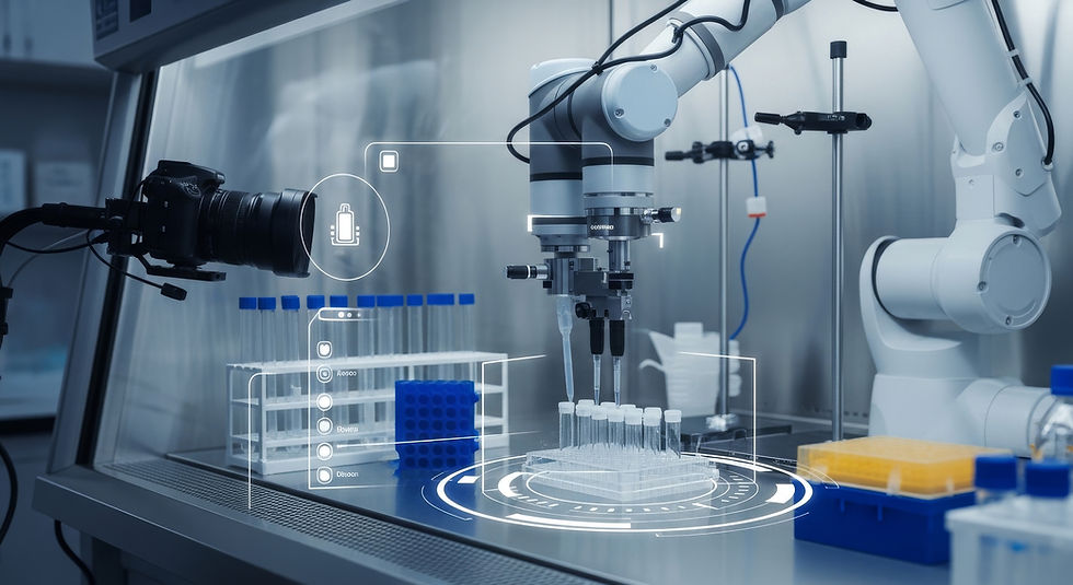
bio
바이오 제조와 연구 환경에서 발생하는 실험 장비 데이터, 공정 로그, 영상 데이터를 통합 관리해 신약 개발과 바이오 공정의 검증 속도와 품질을 높입니다.

Military
군수 공장과 정비 환경에서 장비 데이터를 실시간으로 연결해,
무기체계 생산과 정비의 이상 감지와 작전 대비 태세 강화를 지원합니다.

Autonomous Driving
자율주행 자동차 개발 환경에서 차량 센서와 주행 로그,
영상 데이터를 실시간으로 통합·관리해, 시나리오 검증과 모델 개선을 빠르게 반복합니다.
Smart factory
스마트팩토리에서 발생하는 설비·센서·영상 데이터를 실시간으로 통합해, 공정 최적화와 운영 효율을 동시에 높입니다.

BIO
바이오 제조와 연구 환경에서 발생하는 실험 장비 데이터, 공정 로그, 영상 데이터를 통합 관리해 신약 개발과 바이오 공정의 검증 속도와 품질을 높입니다.
Military
군수 공장과 정비 환경에서 장비 데이터를 실시간으로 연결해, 무기체계 생산과 정비의 이상 감지와 작전 대비 태세 강화를 지원합니다.
SYNC
Databahn은 ㅇㅇㅇㅇ와 연동됩니다.
IMPACT
$8 million
숫자로 표현 가능한 파트리지시스템즈의 성과들을 한 문장으로 묘사합니다
99%
숫자로 표현 가능한 파트리지시스템즈의
성과들을 한 문장으로 묘사합니다
10,000
숫자로 표현 가능한 파트리지시스템즈의
성과들을 한 문장으로 묘사합니다
TRUST
신뢰, 안정성을 보장하는
인증 표식 등을 표현합니다.
신뢰, 안정성을 보장하는
인증 표식 등을 표현합니다.
신뢰, 안정성을 보장하는
인증 표식 등을 표현합니다.
신뢰, 안정성을 보장하는
인증 표식 등을 표현합니다.
신뢰, 안정성을 보장하는
인증 표식 등을 표현합니다.

From forward sensors to rear training servers,
a single platform covers the entire data pipeline.
4-Layer E2E
Data Pipeline.
LAYER 1.0
Logger
Collection
Collects multi-sensor data in real time from drones, robots, and humanoids. Compresses and tags (KLV) data for transmission over forward networks.
LAYER 1.5
UGV Hub
Aggregation
The UGV serves as a forward data hub. Aggregates and buffers data from multiple Loggers, then reliably transfers it to Edge after AI preprocessing.
LAYER 2.0
AI Edge
Inference
Performs AI inference on mobile tactical devices. Supports field decisions through object detection, 3D mapping, and situational analysis.
LAYER 3.0
Rear
Learning
Manages data and performs incremental and federated learning in rear MLOps. Builds enhanced models for redeployment to Edge and Logger.
Fuses diverse sensor and platform data
into a unified 3D space.
Real-Time
3D Context Mapping.
Modern Unmanned Warfare
STEP 1
Multi-Source Collection
Heterogeneous Coordinate Alignment
Converts data from drones, UGVs, robot dogs, and humanoids into a common coordinate system in real time.
STEP 3
3D Map Generation
SLAM+ColoredPCD (orTextureMash)
Enables real-time 3D mapping and free-view rendering, over 100× faster than NeRF.
STEP 2
Spatiotemporal Alignment
LiDAR-Inertial Odometry
Tightly fuses LiDAR point clouds and IMU data for precise localization, even in GPS-limited indoor, urban, and DIL environments.
Data Pipeline
STEP 0
STEP 4
Semantic Overlay
Semantic Segmentation Overlay
Adds semantic labels to visualize targets, hazards, and traversable routes.
Provides three context layers for understanding tactical situations on a geometric 3D map.
Tactical Context Layers.
On the 3D Map


USE CASES
Operational Scenarios.
The 3D Context Map supports situational awareness and decisions across diverse environments.

02
Special Operations
(SOT)

04
Battle Damage Assessment
(BDA)

03
Intelligence, Surveillance
& Reconnaissance (ISR)
01
Military Operations in Urban Terrain (MOUT)
Physical AI
+
Data Infrastructure
+
Ruggedized Hardware
Data transforms the battlefield.
Battlefield-ready hardware
drives combat power.
Raw Data to Intelligence.
DataBahn Defense HW Edition.
01
DataBahn Defense Logger
Forward Data Collection


UGV-Mounted
Drone-Embedded
02
DataBahn Defense Edge
Vehicle-Mounted Edge PRO

03
DataBahn Defense Edge
Vehicle-Mounted Edge CORE

04
DataBahn Defense Kit
Mobile Tactical Edge

Data Infrastructure
for Battlefield Superiority
Databahn Defense.
03
Every Lost Frame,
Counted by Cause
02
A Silent Channel, Named
01
The Configuration,
Before It Records
So Now Our Software
Checks Every Run
One of Ours Did.
A Recording Can Close
Empty Without a Word.
The Failure Every Team Meets
Vigilance Decides
the Test Day
The Earlier You Hear, the Less It Costs.
Every data collection team runs into quiet failures sooner or later.
Our software speaks up at three points in a test day.
02
While on the Road
Channels that go quiet or skip frames get flagged by name on the web UI, a Stream Deck key and the REST interface.
03
Back at Base
Every lost frame is counted by cause, and the moments the operator marked are in the recording, so nothing has to be guessed afterwards.
01
Before the First Mile
Bad configurations come back refused, with the reason, so nobody drives a route on settings that would never record.
A Test Day
With Partridge
From First Check to Media Handover.
Each check has its place in the day, from the
first configuration to the closing handover.
STEP 1
Morning
The Configuration Is Checked
Before It’s Applied
A bad one comes back refused and says why, before anything records and before the first mile.
STEP 2
On the Road
A Silent Channel Is Flagged by Name
A channel that goes quiet or skips frames shows up on a Stream Deck key in the cabin, so the crew knows without opening a laptop.
STEP 3
Marked Moment
The Operator Marks
What Looked Wrong
If something looks wrong on the road, an operator marks the moment in the recording, so it’s easy to
find afterwards.
STEP 4
Media Handover
Raw Files,
With Every Loss Explained
The software records raw and writes MCAP, PCAP and raw files. Every lost frame is counted by cause, so a gap comes with its reason.
What It Runs On, and What It Records.
Leading ADAS programs are bringing edge computers on board,
and our software already runs on them.
RUNS ON
x86-64 PCs and Raspberry Pi 5
x86-64 Linux PCs, including Neousys Nuvo industrial PCs, and Raspberry Pi 5,
in customer deployments in Korea.
NVIDIA Jetson
Jetson AGX Orin and Orin Nano, validated on real hardware. Our port to NVIDIA Thor is in development.
In Deployment
Validated
RECORDS
Cameras
Recorded Raw
LiDAR
Imaging radar
GNSS/INS
CAN and CAN-FD
Automotive Ethernet
PROVEN
In production on two customer programs, and validated on fleets already on the road.
STEP 4
Measured Result
A Measured Figure
With the Conditions Attached
A first fitting has taken one to three weeks. If the result isn’t worth acting on, we’ll say so.
STEP 3
Round-Trip Check
Compressed,
Restored and Hash-Compared
We compress and restore each file and compare SHA-256 digests. One differing bit fails the run.
STEP 2
Codec Fitting
A Profile for Each Stream,
Sized to Your Compute
We fit a codec to each camera and LiDAR stream in the sample, with a build sized to the compute you run in the vehicle.
STEP 1
Sample Transfer
A Short Sample From Your Own Vehicles
Send us around thirty minutes of your own capture. The usual delay is getting the data to us.
The first fitting on a small sample is free, and it ends with a compression figure measured on your own data.
This Is How a First
Fitting Runs.
One Alert, Three Places.
In the Vehicle and in Your Own Tools
When a channel goes quiet, the alert shows on the web UI, a Stream Deck key and the REST interface.
With Thirty Minutes of
Your Capture,
The crew in the vehicle and your own tools see the same alert.
01
In the browser

The web UI, served from the vehicle's own computer. Nothing to install.
02
In the cabin

A Stream Deck key in the cabin lights up, so the crew knows without opening a laptop.
03
In your own tools

The same checks through the REST interface, for the tools your team already runs.
RUNS ON
x86-64 PCs and Raspberry Pi 5
x86-64 Linux PCs, including Neousys Nuvo industrial PCs, and Raspberry Pi 5, in customer deployments in Korea.
In Deployment
Validated
Jetson AGX Orin and Orin Nano, validated on real hardware. Our port to NVIDIA Thor is in development.
NVIDIA Jetson
Leading ADAS programs are bringing
edge computers on board, and our
software already runs on them.
What It Runs On,
and What It Records.
RECORDS
Recorded
Raw
LiDAR
LiDAR
Imaging radar
GNSS/INS
CAN and CAN-FD
Automotive Ethernet
PROVEN
In production on two customer programs,
and validated on fleets already on the road.
01
In the browser
The web UI, served from the vehicle's own computer. Nothing to install.
When a channel goes quiet, the alert shows on the web UI, a Stream Deck key and the REST interface.
One Alert,
Three Places.
In the Vehicle
and in Your Own Tools
02
In the cabin

A Stream Deck key in the cabin lights up,
so the crew knows without opening a laptop.
03
In your own tools

The same checks through the REST interface,
for the tools your team already runs.
The crew in the vehicle and your own tools see the same alert.
PROOF
On the Road
Two Programs
In production on two customer programs, and validated on fleets already on the road.
SENSORS
Capture
Recorded Raw
Cameras, lidar, imaging radar, GNSS/INS, CAN and CAN-FD, and automotive Ethernet.
COMPUTERS
Jetson
Validated
NVIDIA Jetson AGX Orin and Orin Nano, validated on real hardware. NVIDIA Thor is in development.
COMPUTERS
x86 and Pi 5
In Deployment
x86-64 Linux PCs, including Neousys Nuvo industrial PCs, and Raspberry Pi 5, in customer deployments in Korea.
On the edge computers leading ADAS programs are moving to, with the sensors a test vehicle carries.
What It Runs On,
and What It Records.
The crew in the vehicle and the tools your team already runs see the same alert,
the moment a channel goes quiet.
One Alert,
Three Places.
In the Vehicle
and in Your Own Tools
+82 (070)8667-0745
(HQ) 8F, 207 Teheran-ro, Gangnam-gu, Seoul, Republic of Korea
(Defense) 801, 20, Gilju-ro 647beon-gil, Bupyeong-gu, Incheon, Republic of Korea
(USA) 4896 Freer st, Rochester, MI 48306
2026 Partridge Systems Inc. ALL Rights Reserved.